Reigate

20120618-140446.jpg

We spent yesterday in Reigate, a quiet market town in North Surrey. The only camera I had with me was my iPhone so, in the true tradition (if there has been enough time for there to be a tradition) of iPhoneography, I have lightly edited the images on my iPad and uploaded directly from there.

20120618-140821.jpg

Reigate has the remains of a castle so I get to continue my series on castles. The castle was built in the eleventh century and fell into decay in the seventeenth. None of the stonework remains but the earthworks have been turned into a pretty, and peaceful garden.

20120618-142555.jpg

Underneath the castle gardens is a network of caves. The most well-known, The Barons’ Cave, is reputed to have been a meeting place for the barons who devised the Magna Carta. The stone pyramid in the top photographs guards an underground
sallyport.

20120618-142133.jpg

The few remains of the castle were removed in 1777 when the land was converted into a garden. The mock medieval gateway was built at that time.

We thoroughly enjoyed our day in Reigate. The town has a lot of interesting independent shops, a fine array of eateries and an Everyman cinema (in which we saw Prometheus). Best of all, the sun shone: a rare event here this summer!

20120618-142916.jpg

Beachy Head Lighthouse

20120609-223034.jpg

This is Beachy Head Lighthouse, East Sussex. I took this shot on a blustery day in May 2010, as scudding clouds created shadow patterns over the shallow water at the base of the chalk cliffs the lighthouse guards. The lighthouse was built in 1902, warning ships of the cliffs with a light at night and its bright stripes by day. In September, Trinity House announced that it could no longer justify the cost of painting the lighthouse, modern navigational aids making this precaution redundant. Needless to say, many people are reluctant to see the lighthouse fade to grey and a campaign has been running ever since to raise the funds to keep this iconic lighthouse beautiful.

Cowdrey Park ruins

20120607-232652.jpg

More iphoneography, this time taken today at Cowdrey Park ruins in Midhurst, West Sussex.

20120607-233050.jpg

This atmospheric building was once a magnificent Tudor house, visited by both Henry VIII and Elizabeth I.

20120607-233250.jpg

Today it is part of the Cowdrey Park Estate, probably most famous for being the home of British polo.

Guildford Castle

20120605-205447.jpg

Many eyes across the globe were turned towards our little island this weekend as we celebrated the Queen’s Diamond Jubilee. We may not be a very big nation geographically, or even in terms of power these days, but no one can deny we have a rich and long history. Among the signs of that history are the many castles that still stand right across the country. I do love a good castle so I thought I might do an occasional series about them.

20120605-223449.jpg

Guildford Castle is the closest castle to where I live. It was originally a Norman castle, built shortly after the conquest in 1066. Wooden defences were replaced with stone ones during the 12th century. As the only royal castle in Surrey, Guildford Castle became the centre for the county’s administration and justice and the keep, photographed here, housed the county gaol. However, after Henry III’s death in 1272, the castle fell into decline. In 1885, the ruins were bought by Guildford Borough Council. The keep has been renovated and now contains an interesting display about its history. The grounds are now a lovely park, full of beautiful flowers.

20120605-223539.jpg

Walk this Wey: Thames Lock

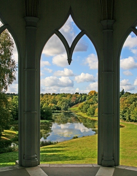
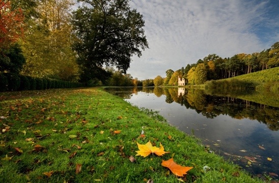
Today’s post is about one of my favourite local places, Thames Lock in Weybridge, Surrey. Thames Lock is the first lock of the Wey and Godalming Navigations.  One of Britain’s earliest man-made navigable waterways, the Navigations, which run for just under 20 miles from the Thames at Weybridge to Godalming, preceded the canal age by a century.  Now owned and managed by the National Trust, the Navigations and their towpath provide a tranquil green corridor through some of Surrey’s most built up areas and a pleasant, easy route through some of its loveliest countryside.

The Navigations were the brainchild of Sir Richard Weston of Sutton Place.  The first ten miles from the Thames were opened in 1653 and extended to Godalming by 1764.  The principal cargo was timber from Surrey’s forests destined for the shipbuilding yards on the banks of the Thames. But the Navigations were also an important route for the transport of wheat, flour and numerous other cargoes, including, in the early 1920s, a number of aircraft from Brooklands.  Today, the Navigations are plied by pleasure boats rather than commercial barges and the towpath is frequented by walkers and cyclists rather than the horses that used to pull the barges.

The entrance to the Navigations from the Thames at Weybridge is misleadingly insignificant in appearance, barely noticeable but for the sign on a post in the river.  Yet it is the location for an exciting passage in local writer, H G Wells’s classic, The War of the Worlds, which concludes as follows:

‘I staggered through the leaping, hissing water towards the shore.  Had my foot stumbled, it would have been the end.  I fell helplessly, in full sight of the Martians, upon the broad, bare, gravelly spit that runs down to mark the angle of the Wey and Thames.  I expected nothing but death.’  (1898)

While not as challenging as evading Martian invaders, finding Thames Lock, where the towpath begins, can be difficult on foot.  A path, known as Church Walk, runs from the side of the Old Crown, a 17th century Grade II listed pub on Thames Street to Radnor Road.  The lock can be reached either via Jessamy Road, which bisects Church Walk or, further along Church Walk, via a small path to the right that leads over a pretty white and green footbridge.

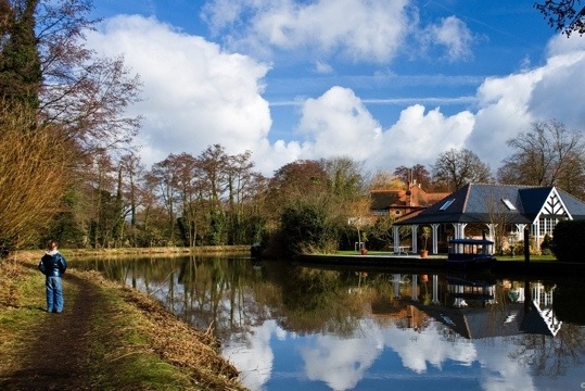
Both routes lead to Whittet’s Ait, an island between the River Wey and the Navigations.  If you follow the gravel footpath beside the public park there, you will come to the lock.  It is a delightful spot, with benches on which you can while away a few minutes or hours watching narrow boats negotiate the lock.   In spring and summer, planters outside the lock keeper’s cottage froth with flowers and it is not unusual to find a local artist at work capturing the idyllic scene.

The towpath begins on the other side, accessed via an iron bridge over the lock. Before crossing, however, it is worth stopping at the lock keeper’s cottage where a free map can be obtained and you can buy a booklet of circular walks along the Navigations.

The present cottage was built by the National Trust in 1975 as a replica of its eighteenth century predecessor.   On the other side of the lock, beside the towpath, stand the stables that used to shelter the horses as they waited for the next barges to arrive.  Now they contain a small display on the history and wildlife of the Navigations.

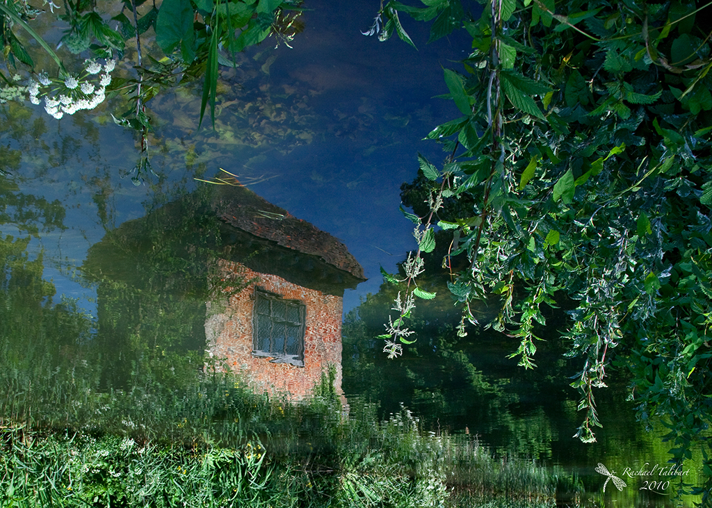
Next to the Lock stands a development of waterside apartments on what was the site of paper, iron and oil seed mills from 1791 to 1963 when the last of many fires on the site finally put paid to further milling.  One account of the fire describes how the water was alight with the highly flammable oil.

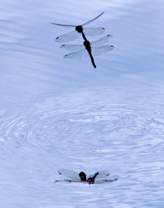
The Navigations are an important habitat for wildlife, from beautiful damselflies …

… to slightly more weird and wonderful critters.

You may even meet an occasional ship’s dog.

Admiring the view

20120524-122154.jpg

A short post today. This scene was taken on my local stretch of the Wey Navigation, a historic waterway that runs for 20 miles between Weybridge and Goldalming, Surrey. Last year I published a series of articles about the Navigation in some local magazines. The text (and some more images) of the first article which includes this picture is here. I will do a more detailed post on the Navigation, its history and wildlife, this weekend.

Romantic runaways

Image

Last year I published a series of articles in some local magazines about the Wey Navigation, a historic waterway that runs for 20 miles from the Thames at Weybridge to Godalming, in Surrey, England. I thought I might occasionally feature excerpts from the series in this blog. Today’s excerpt is about one of the many interesting historical landmarks that can be seen from the towpath. This small brick tower can be found on the stretch between Pyrford Lock and Walsham Gates near the village of Ripley. It is an attractive and unusual structure, fourteen feet square, two storeys high with a first floor entrance and a distinctive ogee-pitched roof. Known as the ‘Summer House’, it bears a blue plaque declaring that: ‘John Donne, Poet and Dean of St.Pauls, lived here 1600-1604’. The story of the romantic runaways is about Donne and his passion for Ann More.

Image

Donne had fallen in love with Ann, the daughter of Sir George More of Loseley Park near Guildford. Ann’s family was too important for her to be permitted to marry Donne so the lovers eloped, when Ann was only 17. This caused a scandal and Sir George organised a search for the runaways. Once they were found, Sir George had Donne thrown into London’s Fleet Prison. On his release, he and Ann were given shelter at Pyrford Place, the home of Sir Francis Wolley, a friend of Donne’s. Sir Francis eventually managed to engineer a reconciliation with Sir George. John and Ann Donne lived at Pyrford Place for a further two years and had the first of their twelve children there. Ann and children lived there for another year while Donne travelled, before the whole family moved to their own home in 1606. It is said that, such was his love for Ann, Donne never got over his grief when she died (having 12 children took its toll!).

It seems unlikely that Donne ever actually lived in the Summer House, which some historians think may not even have been built until later in the century, but the Summer House is in the grounds of Pyrford Place and it is certainly picturesque enough to stand in the imagination as the retreat of a lovelorn poet!

All other things, to their destruction draw,
Only our love hath no decay;
This, no tomorrow hath, nor yesterday,
Running it never runs from us away,
But truly keeps his first, last, everlasting day.

Songs and Sonnets (1611) ‘The Anniversary’

The full text of my article and some more of the images can be viewed here.

Painshill

20120424-094538.jpg

Painshill Park, in Cobham, Surrey, is one of my very favourite local photography locations. An eighteenth century landscape garden, with several ‘follies’ ideally positioned to be ‘picturesque’ in the true sense of the term, it pleases the camera in any season. The top image is a view of the Lake from the Gothic Temple.

20120424-094907.jpg

‘Painshill was created between 1738 and 1773 by the Hon Charles Hamilton, 9th son and 14th child of 6th Earl of Abercorn. A painter, plantsman and brilliantly gifted and imaginative designer, he dedicated his creative genius to the layout and composition of a landscape garden which was unique in Europe and still remains so.’

20120424-095439.jpg

‘Painshill was created as a romantic landscape to stimulate the senses and emotions of the visitor…The gardens were among the earliest to reflect the changing fashion from geometric formality to the naturalistic style.’

20120424-095147.jpg
The ruined abbey catches the morning sun. The use of still water to create reflections was one of the typical elements in landscape gardens of the period.

‘Rescuing and restoring this exceptional Grade I landscape has been very challenging and difficult but ultimately exceedingly rewarding, capped with the award of the rare Europa Nostra Medal in 1998 “for the exemplary restoration from a state of extreme neglect, of a most important 18th century landscape park and its extraordinary buildings”. Painshill Park is of international importance and therefore The Painshill Park Trust now has a long-term aim to become a world heritage site.’
The-Story-of-Painshill

20120424-101927.jpg

The Park is big enough that it never feels crowded. Largely maintained and staffed by volunteers, it is a fascinating and beautiful place to visit.

20120424-102421.jpg

The grotto is another of the follies, and it looks very spooky in fog. Father Christmas holds court inside every year.

20120424-102553.jpg

There is even a working vineyard.

20120424-102649.jpg

Wildlife abounds…

20120424-102716.jpg

… from the small…

20120424-102749.jpg

…to the not so small.

If you are ever in the area, Painshill Park is a must see!

20120424-102919.jpg

There are more images in my Flickr set.

Storytelling (again)

20120418-155511.jpg

Yesterday’s post was about storytelling in a sequence of images. Today’s is about a one-image story. I call this picture ‘Escape’. To the viewer, it tells of a whale that escapes the whaler’s harpoon. It suggests a backstory, the hunt that has failed, and a future story: where is the whaler going, will it be back, and will the whale escape next time?
The original exposure is below. It tells its own tale to me, of a whale watching trip out of Monterey in summer 2008. It was hardy whale watching. By the time the whales appeared, I was one of only a few left on deck. The heavy grey mist never lifted but, when a tall ship ghosted past in the distance, I had my shot. However, it needed some work back at home to ‘age’ the shot in keeping with the historical fiction I wanted to tell. First, I moved the ship further along the horizon to make a more balanced composition and to make it clearer that the ship was disappearing into the distance. I converted the image to black and white and added a sepia tint. Then I added a texture and, finally, did some selective dodging and burning. The original was an unremarkable shot but a little editing turned it into an storytelling image worth keeping.

20120418-155448.jpg

Editing in Photoshop CS4. Texture courtesy of skeletalmess.

Holt’s Orchard

20120414-102943.jpg

On this day in 2009 we were travelling through Utah, on our way from Moab to Bryce Canyon. On the way, we drove through Capitol Reef National Park. We only had time for one stop, but as we drove through the stunning scenery of burnt orange canyon walls and rippling yellow grasses, we resolved to return. We stopped in the rather prosaically named Fruita, where the principal industry used to be the growing of, you guessed it, fruit. The top picture is Holt’s Orchard, in Fruita. In 1878, a small group of Mormons settled this land by the Fremont River. They found the climate suitable for growing fruit and, now run by the National Parks Service, the orchards continue to flourish today, the Spring blossom making a striking contrast with the imposing red walls of the canyon. Life was hard for those early settlers. This orchard was planted by the Holt family and a little plaque tells their moving story, from the death of their daughter at 3 months from a scorpion sting to the loss of their farm a few years later in one of the many devastating flash floods to which the area was prone.
The Mormons were not, however, the first settlers of this area. Ancestral Puebloans farmed this land from 700 to 1300AD and, just over the road from the Holt Orchard, a boardwalk now runs along the canyon walls to make viewing possible of the many intriguing and beautiful petroglyphs that remain as evidence of their presence (see picture below).

If you are interested in this area of the United States or you are looking for an really rewarding new blog to read, can I recommend Travels with the Blonde Coyote

If the link doesn’t work for you (no idea what I’ve done wrong!), try copying and pasting this into your browser: http://theblondecoyote.com

20120414-103613.jpg

20120414-103646.jpg